 Land
THE LANDOS PRODUCT TOUR
One property.
Every next move.
Research the land. Reach the owner. Work the reply, close the deal and manage what you own. See the actual tools behind the connected workflow.
Explore the sample companyNo card required. These previews use example records.
A few clicks. The whole operation.
Follow the work.
Actual product screens and illustrative work records, from research to sale.
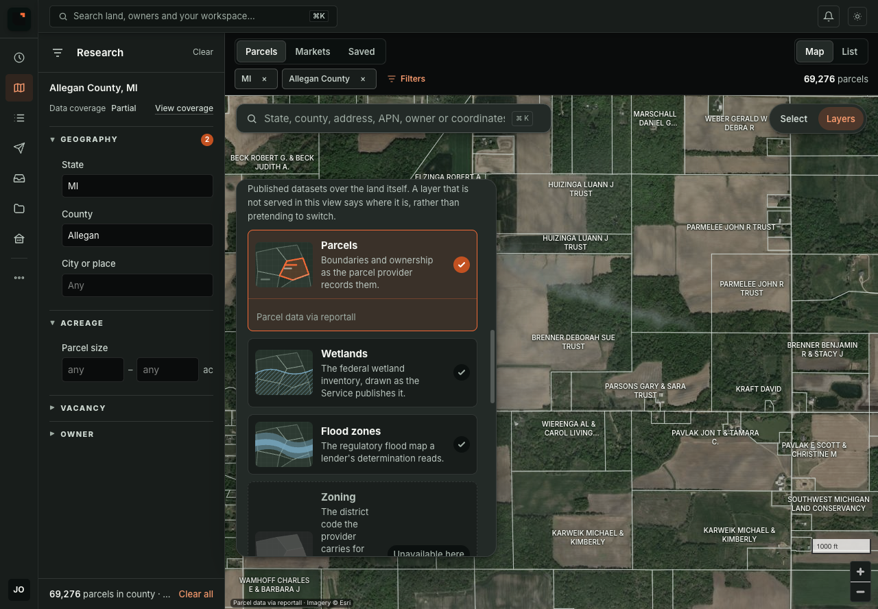
Your next market. Anywhere in the country.
Research nationwide parcels, owners and property details. Compare available sales, price per acre and market activity before you build your list.
- Search by place, owner or APN.
- Ownership, acreage, assessed values and recorded sales where available.

Find the land. Find the owner’s number.
Save parcels to Lists, group the owners and run skip tracing in LandOS. Contact results stay attached to the owner and property.
- See which owners have contacts and which need research.
- Move the same list into SMS campaign preparation.

SMS campaigns. With the context built in.
Prepare and schedule SMS marketing from your Lists. Track delivery and work seller replies in the same platform, with the property already attached.
- Review timing and eligibility before sending.
- Open replies with the property already attached.
One reply. A clear next action.
VA · Seller is open to an offer. Property and conversation ready for review.
Landon · Classified as Needs price. Human pricing review required.
Work the seller, with the whole picture.
Your team and Landon AI work from the same seller conversation, property and history.
- Keep team discussion private beside the seller.
- Route pricing decisions to the right person.
Know the numbers. Know what’s next.
✓ Review title
✓ Review taxes
○ Confirm legal access Needs attention
Make the decision with the numbers attached.
Keep the seller’s ask, valuation, offer target and diligence in view as the deal moves forward.
- Track the decision and its supporting context.
- Surface the blocker before the next milestone.

Own the asset. Watch the listing.
Track Zillow listings and authorized MLS feeds beside the property’s invested basis and exit economics. Keep price, status and available listing history together.
- Follow source-available listing updates from Portfolio.
- Keep the history from parcel research through sale.
TRY THE OPERATING SYSTEM
Make your next move
in LandOS.
Explore a complete sample company, then review your plan before activating your own workspace.
No card required. See platform plans.
Start with one parcel.
Learn the research process, then bring it into your workspace.